Pathways for Wildlife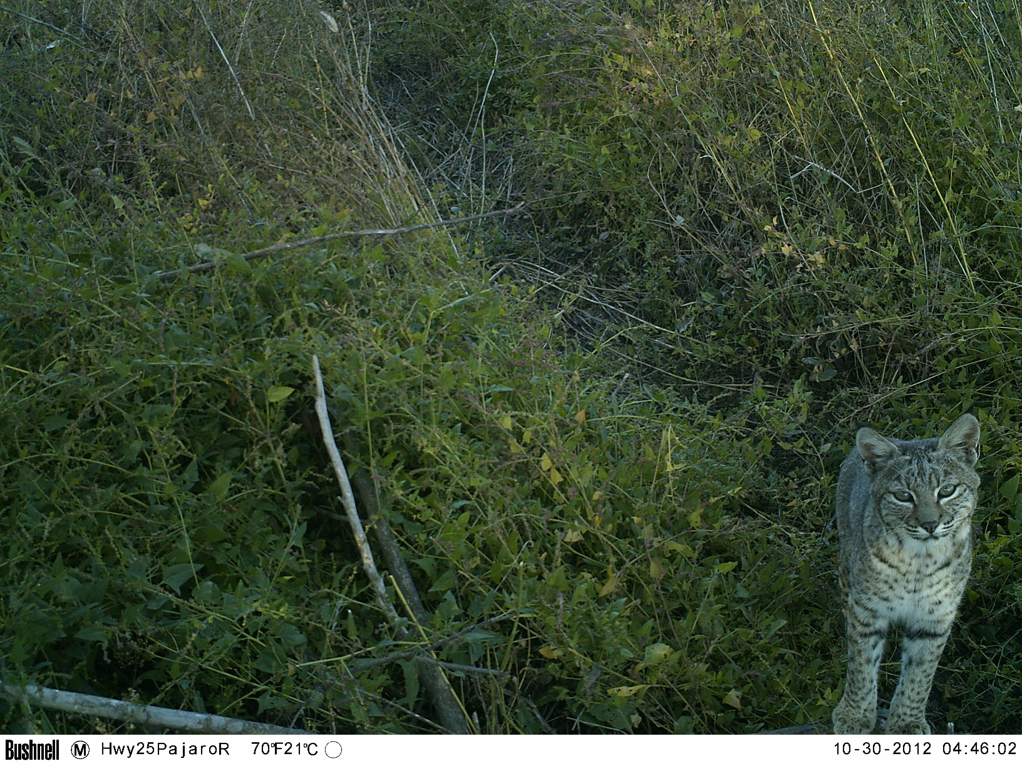
Pathways for Wildlife
Los Gatos, CA
United States
ph: (408) 891-9833
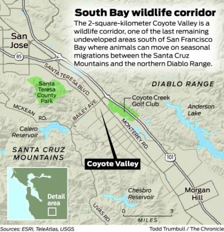
Coyote Valley Linkage Assessment Project
Introduction
Coyote Valley is a critical linkage that allows for animal movement between the Santa Cruz Mountains and the Diablo Range. Little is known about gene flow and animal presence across the valley floor between the two ranges.
The current study is investigating animal movement and habitat permeability across Coyote Valley. We are using (1) genetics for two animal species to determine the extent of gene flow, and (2) camera traps to identify key locations for wildlife movement and habitat use across the valley floor. We will evaluate ground squirrels, which have small home ranges and restricted mobility and may be more fully isolated due to habitat fragmentation, and bobcats, which are more mobile and often a focal species for conservation. Our results can be used to inform land acquisition, restoration, and enhancement – including the development of a regional linkage design that facilitates wildlife movement across the urban-rural gradient unique to Coyote Valley.
Research questions
(1) Is gene flow occurring across Coyote Valley? Are there cases of genetic differentiation or isolation among animal metapopulations?
(2) What pathways do animals use to move through Coyote Valley? What landscape features correlate with animal presence and are critical wildlife pathways?
Project Principal Investigators (PI’s):
Pathways for Wildlife: Tanya Diamond & Ahiga Snyder: Habitat Suitability Modeling, Linkage Mapper Analysis, & Field Research.
UC Berkeley: Adina Merenlender & Morgan Gray: Genetic Analysis & Occupany Modeling.
Project Funders:
1) The project is funded by the Department of Fish and Wildlife (DFW) through the Habitat Conservation Plan (HCP) Local Assistant Grant.
2) The bobcat genetic study component of the project is funded by the Guadalupe - Coyote Creek Resource Conservation District (GCRCD).
Project Manager:
The conservation organization managing the project is Santa Clara Open Space Authority, Galli Basson (OSA).
Project partners:
Guadalupe - Coyote Creek Resource Conservation District (GCRCD), Santa Clara County Parks, Santa Clara Valley Water District (SCVWD), Santa Clara Valley Transportation Authority (VTA).
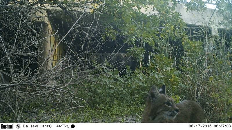
Bobcat traveling through a Fisher Creek Culvert in the heart of the valley floor.
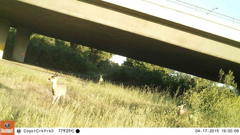 Deer travling under the Bailey Underpass at Coyote Creek County Park.
Scope of Work and Research Methods
Work in Progress
1) Gene flow across Coyote Valley: Genetic analysis of ground squirrels
We will use ground squirrels as a focal species to compare genetic variation across a land use gradient in Coyote Valley to evaluate the extent of gene flow across both sides of Highway 101, and identify the genetic relatedness among ground squirrel metapopulations. We will collect scat at several sites throughout Coyote Valley. Using molecular markers unique to ground squirrels, we will determine the genetic diversity of the population.
2) Gene flow across Coyote Valley: Genetic analysis of bobcats
To complement the research done in Phase 1 on ground squirrel genetics and bobcat camera detections, we will also include bobcat genetics in our assessment of landscape connectivity. From the bobcat genetics we will obtain a quantitative measure of the relative isolation associated with habitat fragmentation and disturbance in Coyote Valley. We will conduct scat surveys by systematic transects and collect hair samples at camera stations using hair snare rubs. Using molecular markers unique to bobcats, we will determine the genetic diversity of the population.
3) Bobcat movement within Coyote Valley: Camera trap detections and bobcat occupancy model.
We will use bobcats as a focal species to document how mid-sized animals move throughout the landscape. Because bobcats can be identified by their unique stripe and spot patterns, photographs from camera traps can be used to estimate their population size. We will collect bobcat surveys using camera trap arrays. To evaluate habitat use by bobcats across Coyote Valley, we will create an occupancy model for the region using our camera trap detections and existing maps of vegetation, digital elevation models, road types, and hydrology. We will extrapolate the model across the valley floor to estimate key areas of land use by bobcats. Using these three sources of data and existing maps of regional land use, we will create a community assemblage-based landscape permeability map for Coyote Valley.
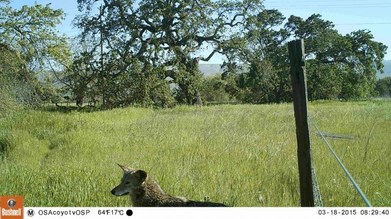 Coyote at Santa Clara OSA's Coyote Valley Open Space Preserve.